Ground Conditions
Time: At the summit around 1130
Snow above: 400m
Route taken: Llanberis path, PyG path
Next report: Tuesday 25-11-25
Conditions
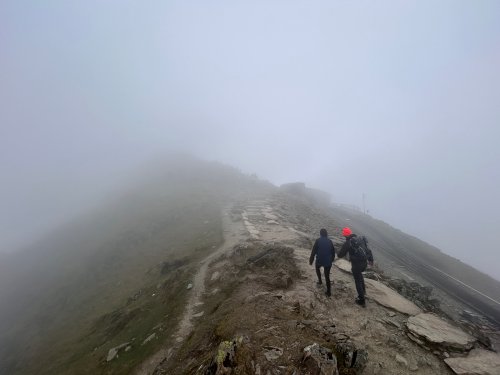
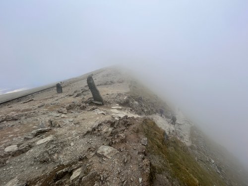
Snow was lying on the mountain above about 400m today. Variable conditions were seen across the mountain with areas of hard ice (at different heights including low and high on the mountain), areas of thin wind scoured snow, snow that had drifted and accumulated in sheltered areas, and hard compacted snow on the paths.
In some places the surface layer of new snow or hail, or deeper soft snow meant that there was relatively good purchase underfoot. In other places there was hard ice, wind scoured snow, or compacted snow, leaving areas that were hard and slippery underfoot.
It looks likely that there will be a significant thaw tonight (Friday night), and into Saturday morning, meaning that conditions will be different in the coming days, less wintry on the whole, but that wintry conditions underfoot may persist in a number of places for a while (or even reappear - see Additional Information below).
A sunny day with light winds to start with clouds and the occasional snow shower rolling over the mountain towards afternoon.
Essential equipment
Suitable seasonal walking equipment, including lighting (such as a headtorch or two each).
Carrying snow goggles (like ski goggles) will protect the eyes from cold winds and drifting snow, making it easier to see in order to travel more safely on the mountain.
Carrying an ice axe and some form of crampons will offer safer options when encountering snow and ice on the mountain.
Additional Information
On the Friday of the report the forecast suggests that the temperature at the summit will be below freezing to begin with, close to or above freezing for a period, before falling below freezing again by Tuesday. The temperature at the summit is forecast to be as low as -1ºC (feeling like it is as low as -10ºC at times). While the temperature will be slightly higher in the coming days, it will feel just as cold, if not colder, as the temperature remains low, but with wind and rain also contributing to cooling.
With the temperature rising above freezing, and rain forecast, it is likely that there will be a significant thaw by Saturday morning, with more general thawing possible after this. Despite this the temperature will still be relatively low, and close to freezing higher on the mountain. This means that it is possible that areas of snow or ice will persist on the paths for a while, or possibly until a potential refreeze again on Monday night. This will most likely be where areas of hard ice, or thicker snow have accumulated higher on the mountain, and while they continue they will still present the same winter hazard, possibly being more slippery due to their wet condition.
With periods where precipitation is forecast, and temperatures close to or below freezing, there is also the possibility of new snow and ice developing higher on the mountain, even if the current snow melts completely. Even if the mountain is clear of snow and ice by Saturday, it is possible that more wintry conditions will have returned to areas higher on the mountain before Tuesday.